So Monday I took a vacation day off from work, and since the weather was good, I took off in the morning to see how far I could get around some old and new trails in the Northlands. Here are a few notes, and a few pictures, from that trip.
First, if I wanted to head south, I could go about a mile and catch the Chouteau Trafficway trail, and then ride trails along the river to downtown and other places south. But to get to something North, I have to go three miles before striking a trail. In Monday’s case, that three miles was westward to Briarcliff and catch a Riverside trail that curls around to the bottom of the Line Creek Trail on Vivion Road.
The trail in Riverside is a nice gentle rollercoaster along NW Platte Drive until it loops into the hills and away from the road, going gravel and eventually dust and mud for about half a mile. Somewhere after NW Woodland St. it picks up pavement again, along with some historical signs about Riverside’s historic trolley system. Then it links up to the bottom of the Line Creek Trail.
The bottom part of the Line Creek Trail parallels NW Waukomis Drive through some wooded parkland along a streambed. That means the air along the trail is usually cooler than outside the trail. On warm spring, summer and fall days in Kansas City that is a real plus. Monday wasn’t a warm spring day – at least not this morning. The high was supposed to be 62, but since it started near freezing (frost in some areas), it was still rather nippy as I rode north along the trail on Monday morning.
There is as section of the trail, just a bit south of the Gower Trail Head, that is actually a dual public/private road and trail. I don’t know the history, but from what I can tell, when they wanted to put the trail through the one section happened to be the access road for about 4 houses along the trail. So a deal was struck where the owners of the houses keep their right-of-way to drive in and out to their houses, but for everyone else it is a bike trail. I had a short conversation with one of the owners about this earlier this year (was it that warm week in January?) and it seems like it is one of the better public/private success stories, where everyone wins without eminent domain having to be bandied around.
If you are coming from the south, do know that the trail does continue north after the Gower Trail Head. Since I came from the south, I always ended my ride there for several months, before realizing that if you take a somewhat long jaunt to the east and then cross at the crosswalk, the trail continue north along the east side of NW Waukomis drive before veering through the Platte Brooke North greenway. The connection between the two parts is not marked AT ALL as far as I can see.
By the time I was headed into the Platte Brooke North section I was paying special attention to my odometer, because I knew a special milestone was in the offing. And sure enough, just as I passed the NW Platte Brooke Drive trail entrance, my odometer crossed the 500 mile mark. I had ridden my bicycle 500 miles in the year 2015!


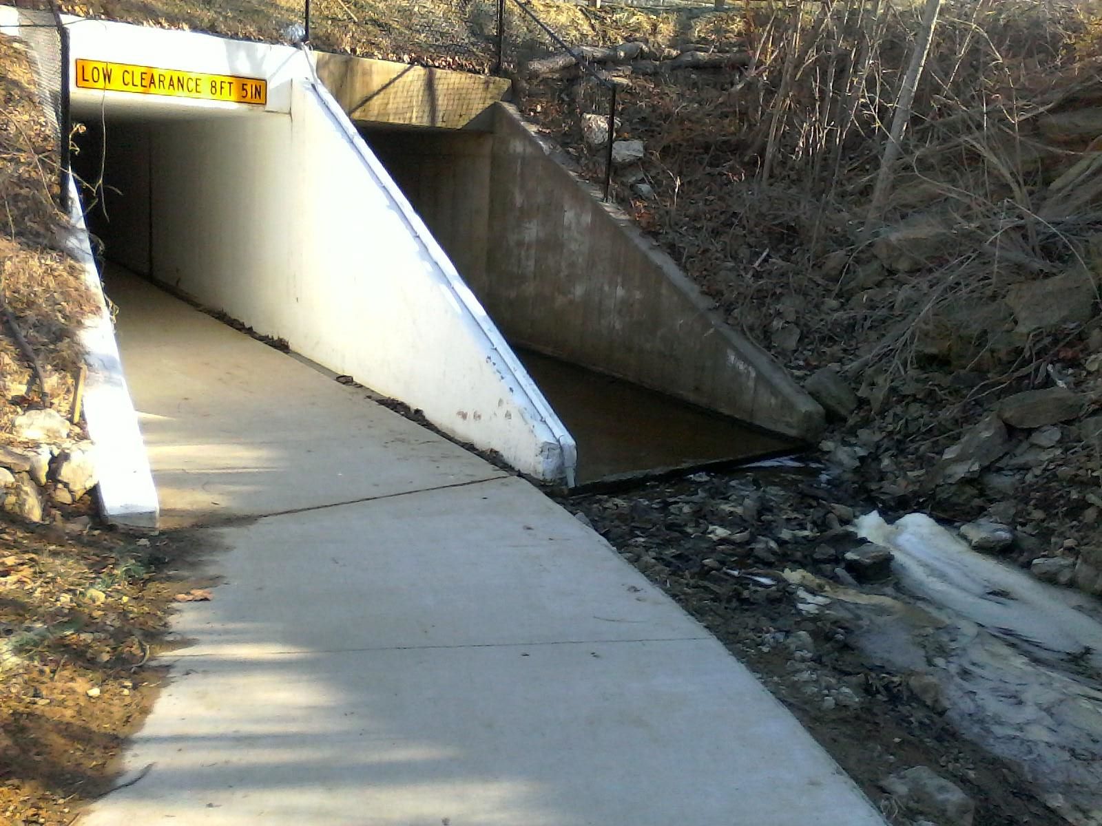
Past that trail entrance is where most of the elevation climb on the Line Creek Trail occurs (though there are two significant up and down areas on the lower portion of the trail). Once you get through all of that, you reach Barry Road. The trail splits in two: One way takes you up to Barry Road and a crossing at grade, the other way takes you along a loop down below Barry Road and through a culvert trail underneath Barry Road. Monday morning that culvert was still very cold, and there was ice both on the stream that ran through the one side of the culvert, and on a couple of small section of the trail portion of the culvert as well.
When I was climbing out of the culvert well on the north side of Barry was when I first felt the sun as actually warm on Monday morning. I followed the trail further north, and then took the leg that followed Route 152 west on the south side. At Green Hills Road the trail switches sides and continues west on the north side of Route 152. There is a section of the trail that does an S-curve as it goes down and back up. It is marked as slow. Must be for people on really speedy bicycles, and I can take it as 20-something MPH without any sense of hazard.
This leg of the trail seems to end into Ambassador Drive. Once again, the trail continues, but you have to know where it goes. Straight ahead of you, up a steep bank, is the Tiffany Springs Golden Corral. If you cross Ambassador Drive and go just a bit north, you will notice a sidewalk comes down the hill to meet the sidewalk. The bottom of the hill was covered in dry mud, which made the turn precarious at anything but a very slow speed. But once you get to the top, you will find that the trail goes all the way along the back of the Tiffany Springs shopping center that includes Home Depot, PetSmart, Target, JC Penny and Chuck E Cheese. And there it ends.
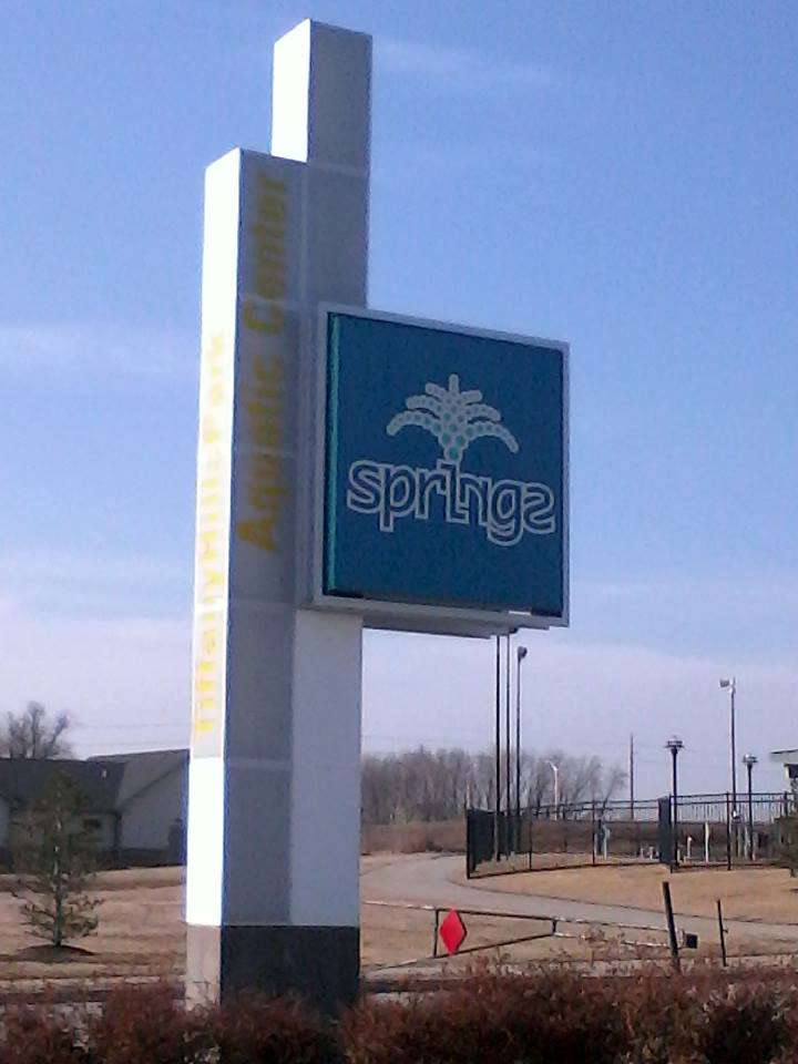
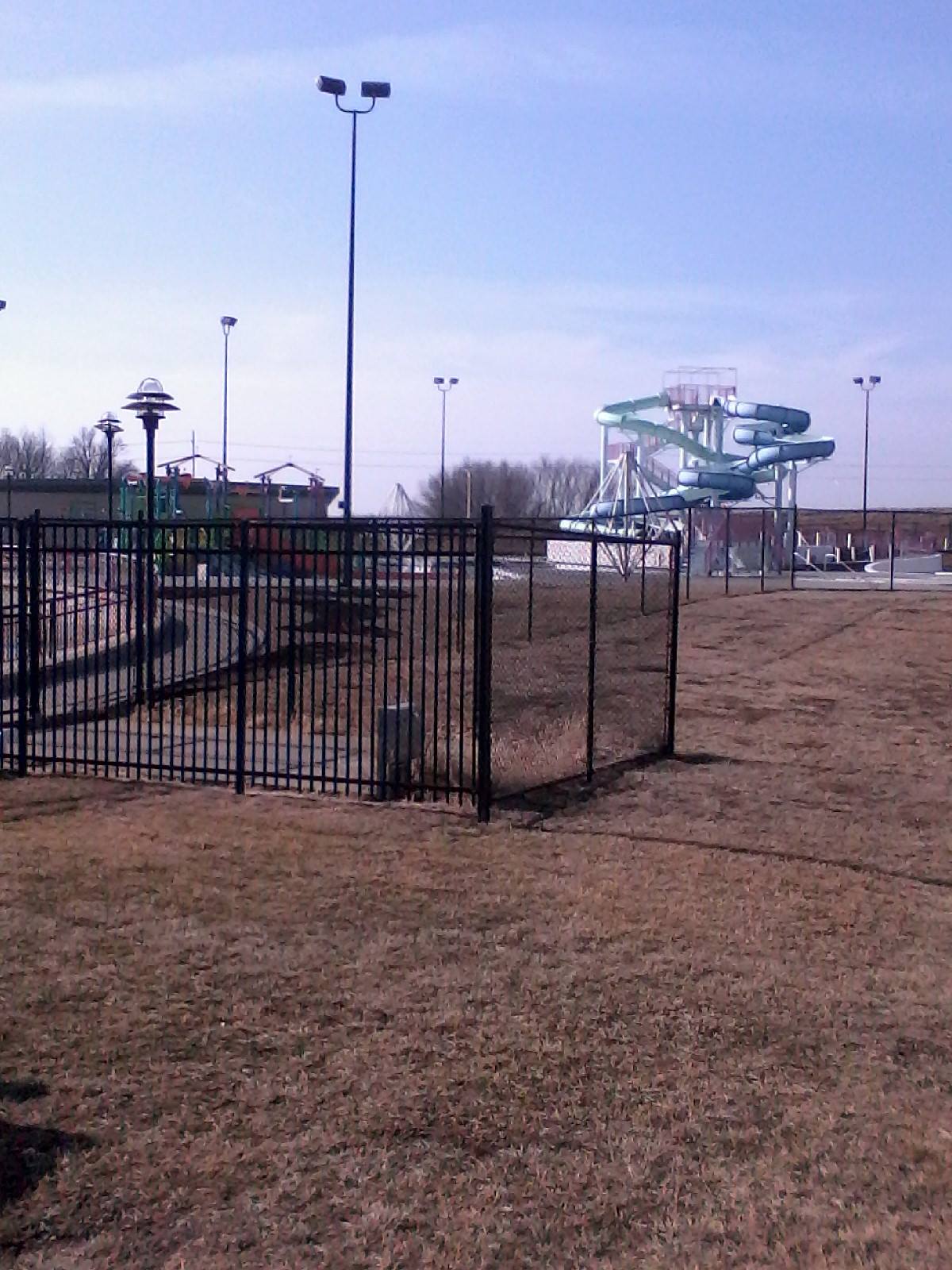
Or at least that was as far as I could see the trail going. I had to go through a lot of parking lot to get to an exit to the plaza, and follow several short section of start-again-stop-again sidewalk to get to Old NW Tiffany Springs Road. A twist of that and I was crossing I-29 and headed toward the Tiffany Hills Park – which was closed. Why would a water park be closed at this time of year, anyway?
From there I took a “straight” shot down NW Congress Ave. On the maps I have Congress is clearly marked as a bicycle trail. I’m not sure exactly why. It has a bicycle lane that comes and goes, and a sidewalk that comes and goes, and when it is there, the angles for crossing streets is entirely un-bicycle-friendly. Nevertheless, the road itself is nice to ride upon, and I made it smoothly to Route 9, which I followed into downtown Parkville.
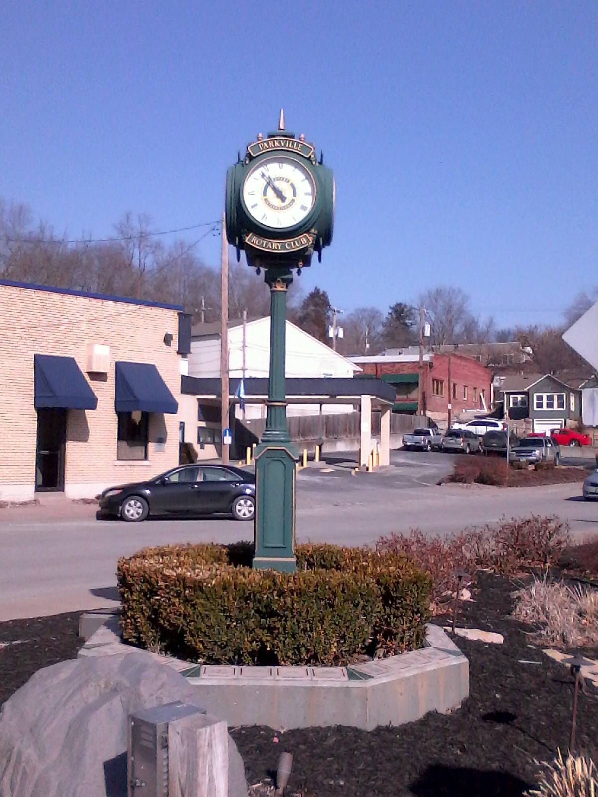
Now, I have heard people talk about the excellent riverside trails in Parkville, but this was my first time to try them out. They were fine, but I wasn’t overly impressed. Most of the other trails I had ridden on were asphalt or concrete. This was mostly packed dirt or gravel. And the trail follows the river east to a point at the end, with a little loop for coming back. Being nosy, however, I saw that we were beside a railroad track, and that there was a space between the railroad track and someone’s private fence that you could walk/ride for about 100 feet before hitting a parking lot. So I rode along the fence, through the parking lot, crossed the tracks at a crossing, and started down Route 9.
Right as I crossed into Riverside there was a sign for the Missouri Riverfront Trail, to the right. But every road to the right was some business’s private drive, no exit, no trespassing, etc. I finally went down to Horizon Parkway and road south to the end to find the trailhead between zones 2 and 3.
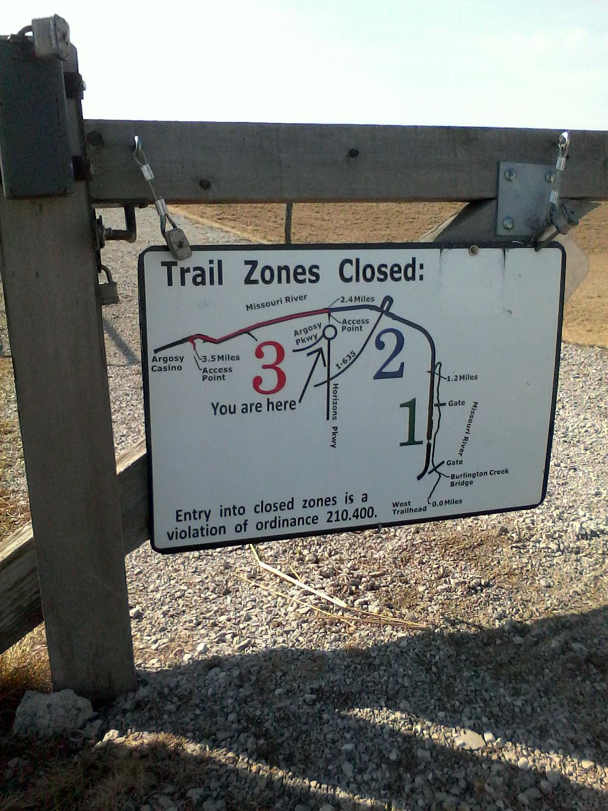
Based on the sign, I figured I was in luck. No trail zones were closed. I was tempted to go back went the 2.4 miles to the west trailhead, but had someplace I wanted to be for lunch, and didn’t think I would have enough time, so I decided to go east along zone 3. But when I got up to the trail I saw the below sign in the zone 3 direction:
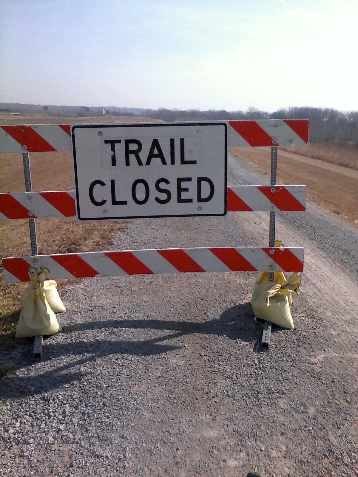
The direction I wanted to go in was the one direction closed. So instead I had to follow the Argosy Parkway until I got to the other end of the trailhead, where I saw the same signs that the trail was open, and yet the trail was closed. Now, I don’t mind the trail being closed. What I do mind is having the trail closed when you get to it, but having the trailhead sign telling you it is open.
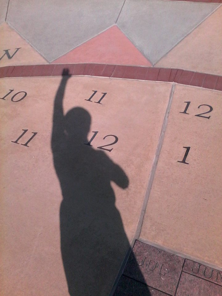
I followed the Argosy Casino Parkway (not to be confused with the Argosy Parkway) over the railroad tracks, and then jumped onto the lowest end of the Line Creek Trail that took me through Jumping Branch Park. From there it was a short stretch to downtown Riverside, where I tried out the sundial. It worked fairly well, as long as I raised the correct arm. If you raise a different arm, you get a different time. I didn’t notice anything in the instructions that was very specific about that part.
By this point I was back on more familiar ground again. I hopped on the next section of Line Creek Trail, got off at the Line Creek Arena trail entrance, took NW Waukomis drive to NW Englewood, and followed Englewood over to the Panera at Creekwood Commons. After lunch and a long rest of reading and writing on the computer, I finished the afternoon with a jaunt down Oak to the Anita Gorman Park, past the Northland Fountain (which still had ice) and followed that trail until it ran out, and then the final 2-3 miles home without a trail.

And that is how you can do 40 miles in Kansas City North, trying to connect the various unconnected trails that make up the trail network.
